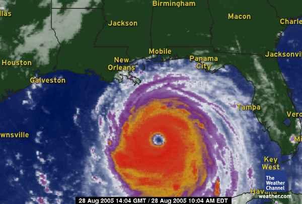
This is Katrina, a category 5 hurricane that is heading for US! (Actually, a little to the East of us, which is a good thing.) She's a beaut, isn't she?! I just thought I should blog about her before we lose electricity!
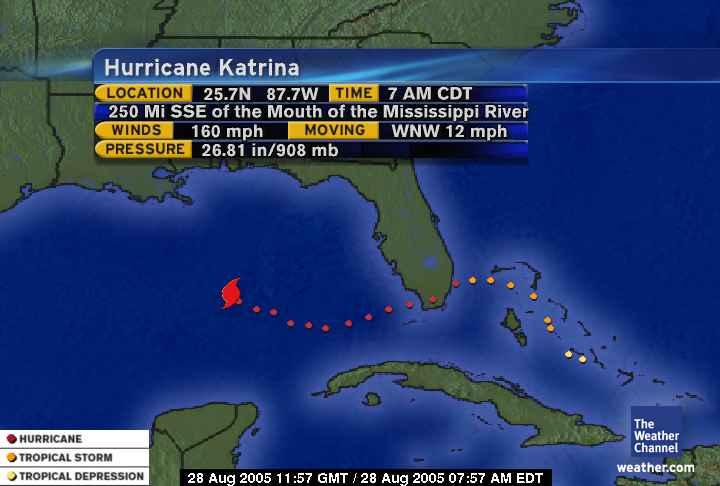
This pic contains some info about Katrina. You might notice that winds are at 160 mi. That puts Katrina at a category 5 hurricane. For those of you land-lovers, IT DOESN'T GET ANY WORSE THAN A '5'!!! Category 5 = 'total catastrophe' according to hurricane size charts. And pressure is at 908mb. The lower the pressure, the stronger the hurricane. Hurricane Andrew (another 5 that hit Florida several years ago) had a significantly higher pressure, which means that Katrina is the same size, but more intense. Last year, Ivan hit the Alabama coast with a pressure of 909 or 910mb.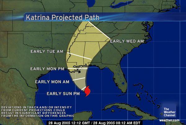
This is Katrina's projected path. We are just to the West of the projected path. There is some sort of high-pressure trough across northern LA, which is pushing it East. I'm hoping that it passes to the East of New Orleans, because it would be really bad for New Orleans to get the eye. The city of New Orleans is actually below sea-level, so it fills up like a bowl. The most severe areas of a hurricane are the eye and the Eastern side of storm, because that's where the worst winds are. We will see some of the weather, but the bands will be much weaker by the time they get around to us.

No comments:
Post a Comment